Birding Safari

Willet

Willet

Ask Google what the word Safari means and this is the response:

The Swahili word safari means journey, originally from the Arabic adjective سفر (safar) meaning a journey, traveling, touring or voyaging; the verb for "to travel" in Swahili is kusafiri.

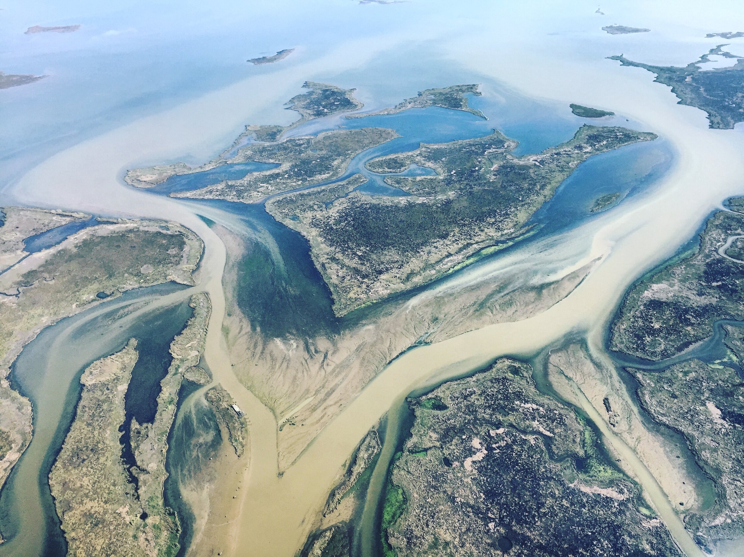
You don’t have to travel to Africa to have a safari. The Mississippi River Delta offers incredible opportunities for spending the day on safari bird watching.

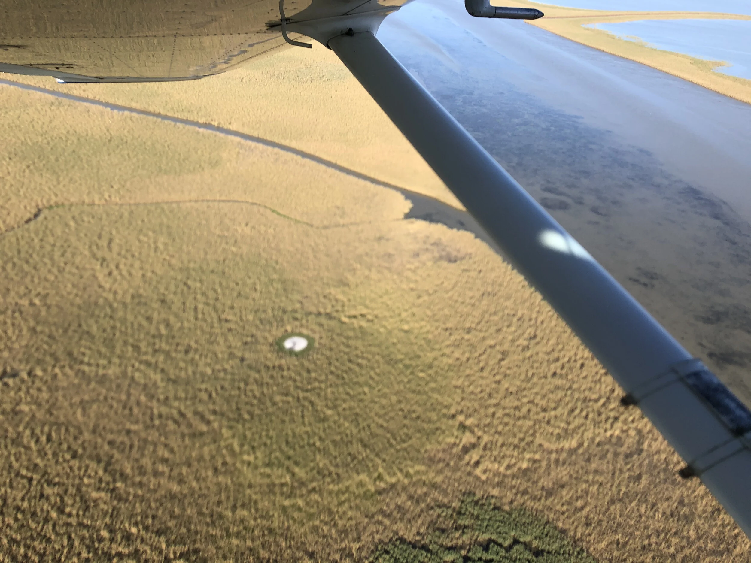
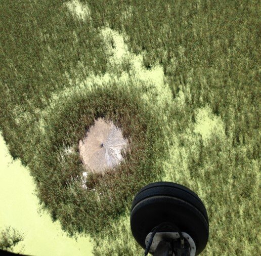
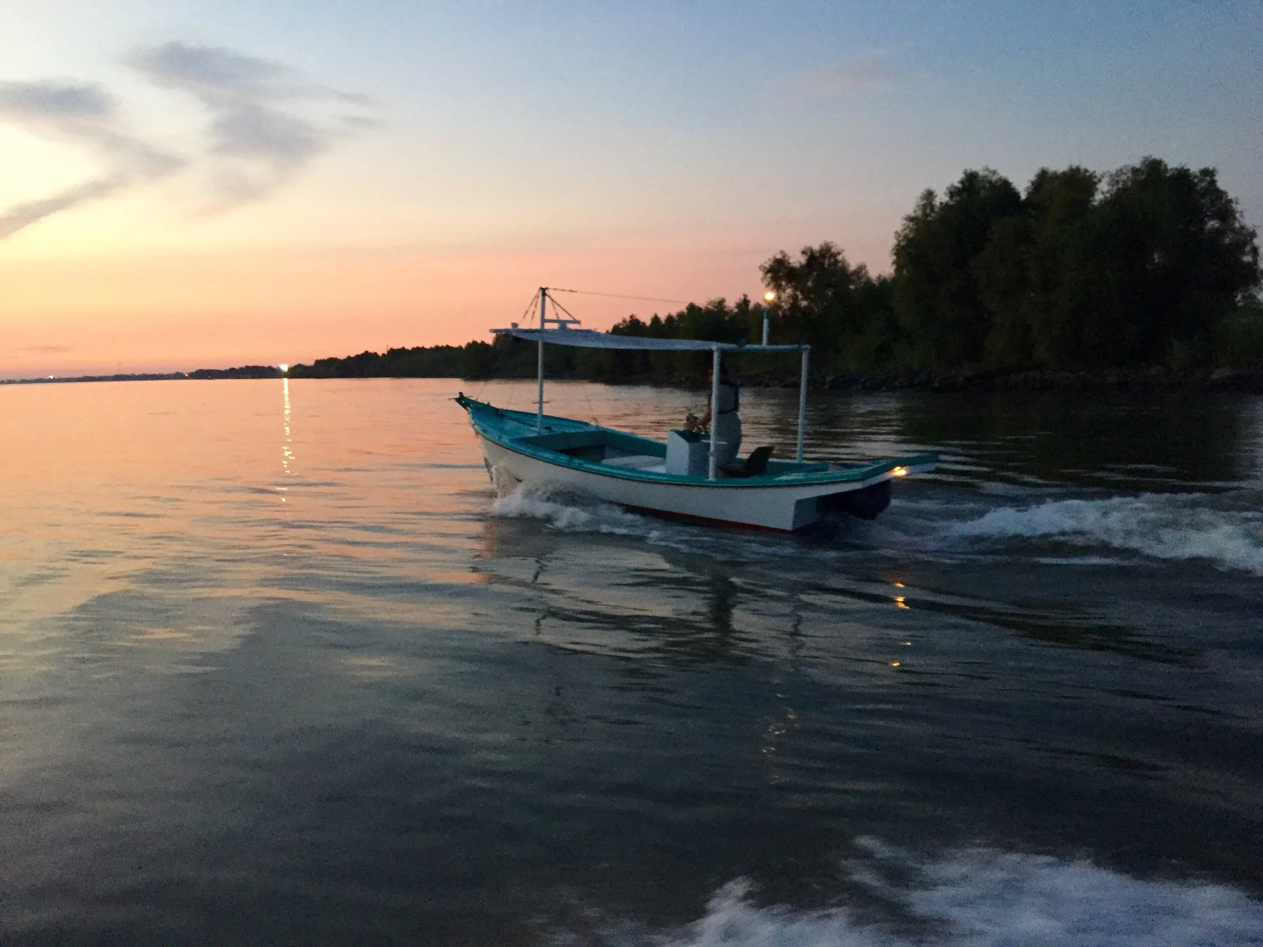
Our Birding Safari is the perfect way for birders to see dozens of species. We cover sixty miles over six hours and cross a variety of coastal sub types -from the Mississippi River itself, to barrier islands, and all the swamps and marshes between.

Brown Pelican

Brown Pelican

Volume and variety are the themes of the trip. The delta is an incredibly productive ecosystem that supports a wide variety of species. Countless birds call the delta home year round, pass through on migration, or spend time seasonally.

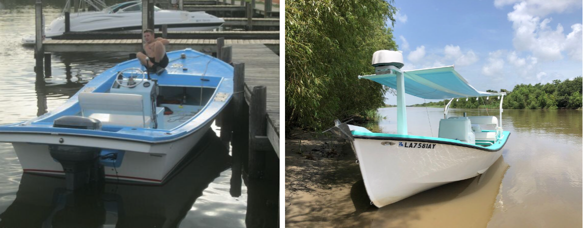
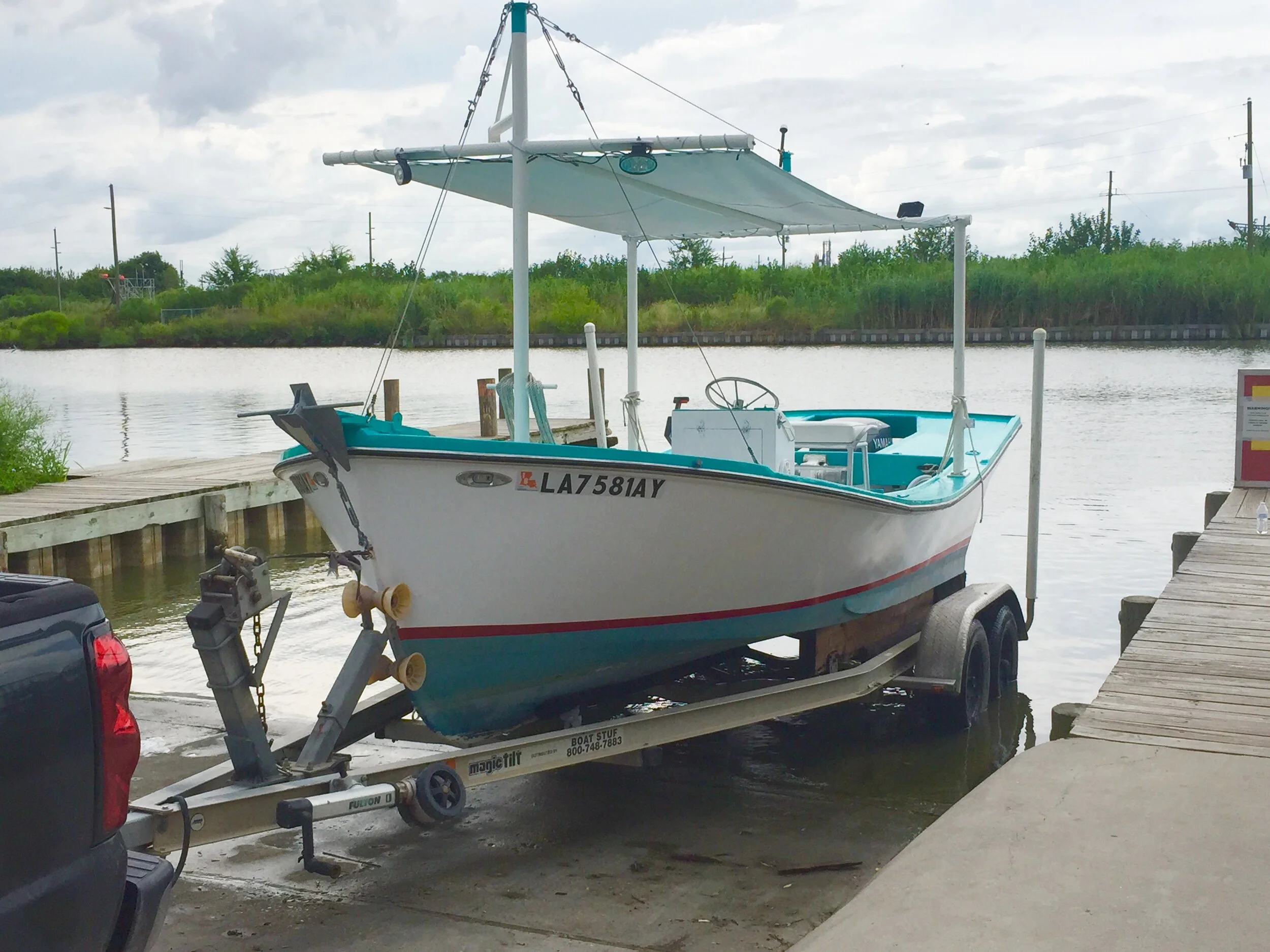
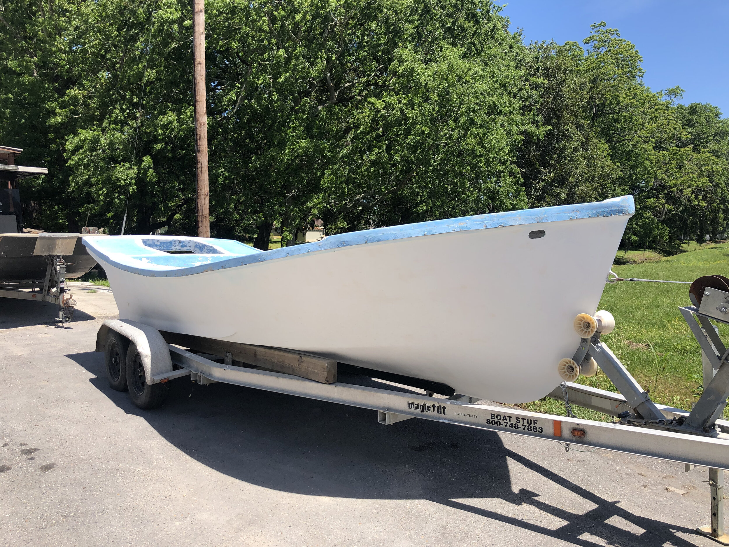
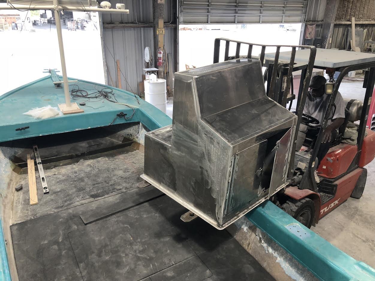
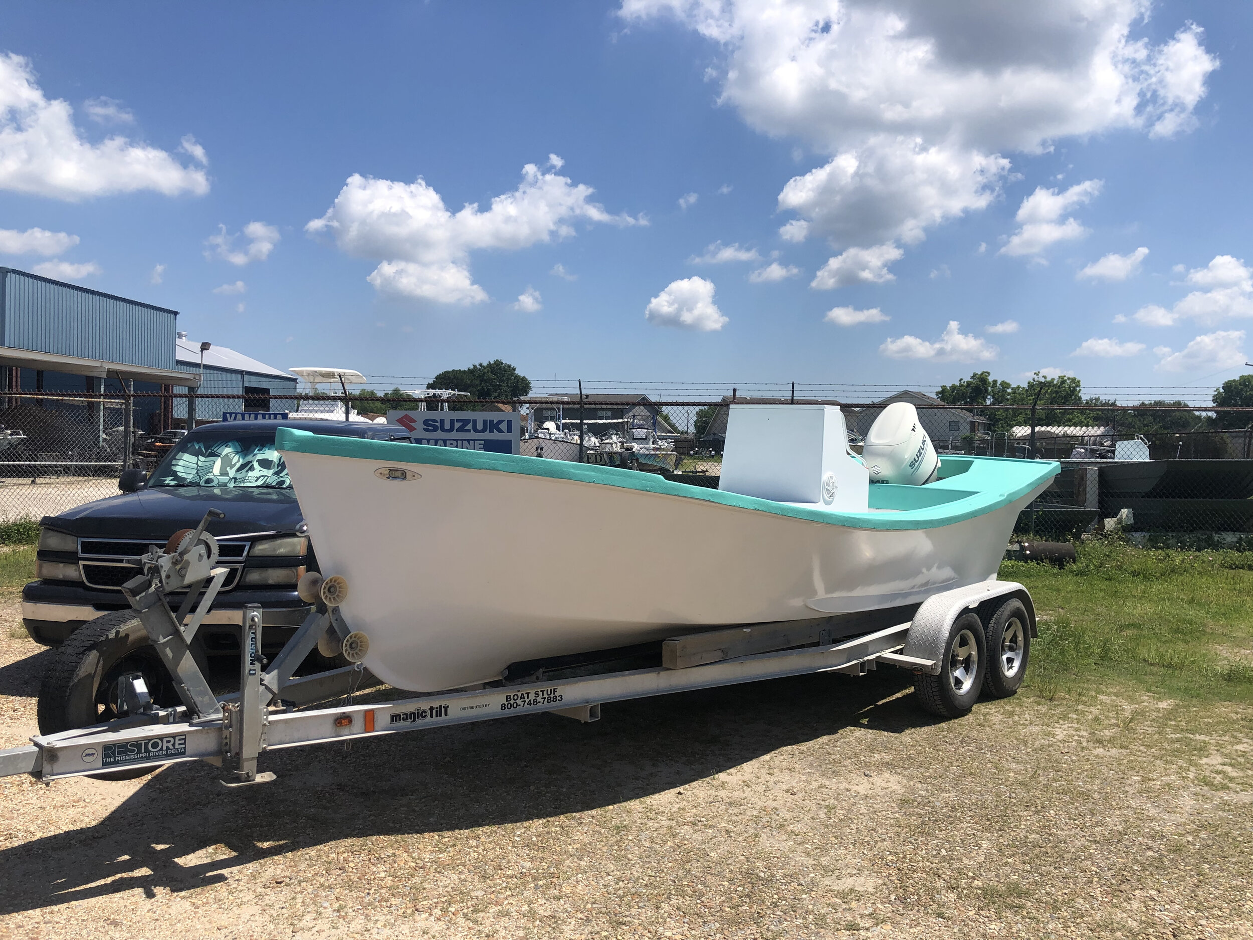
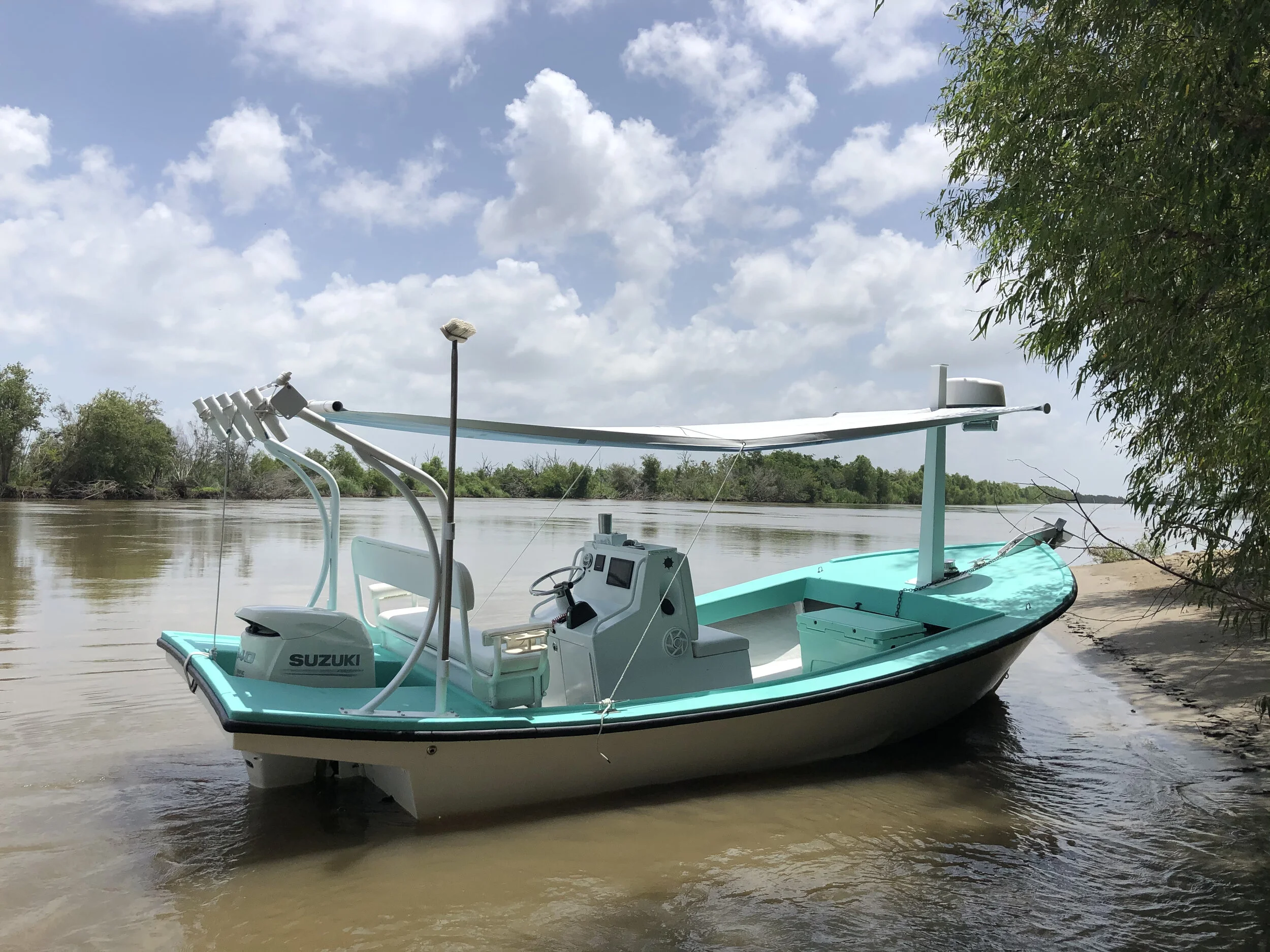
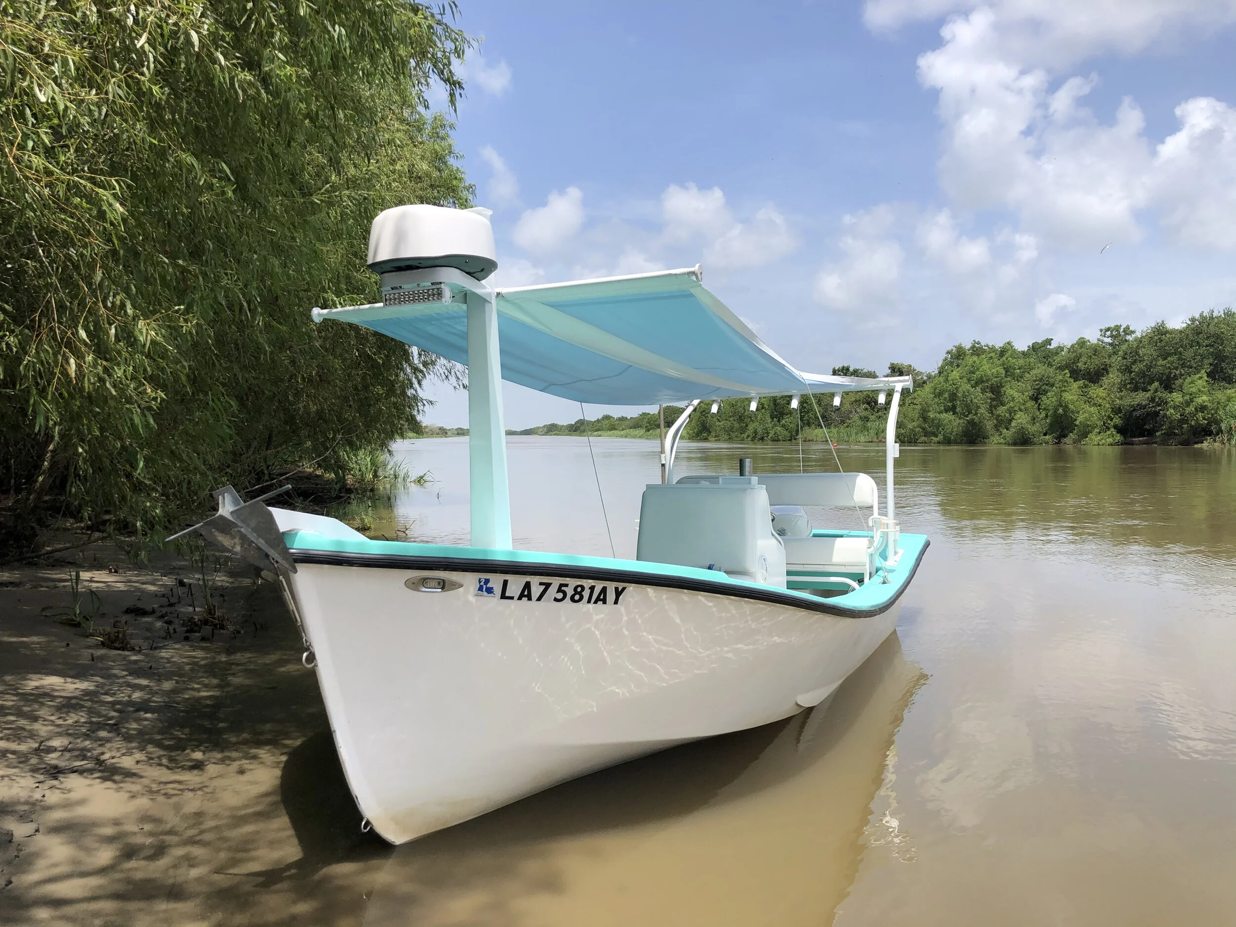
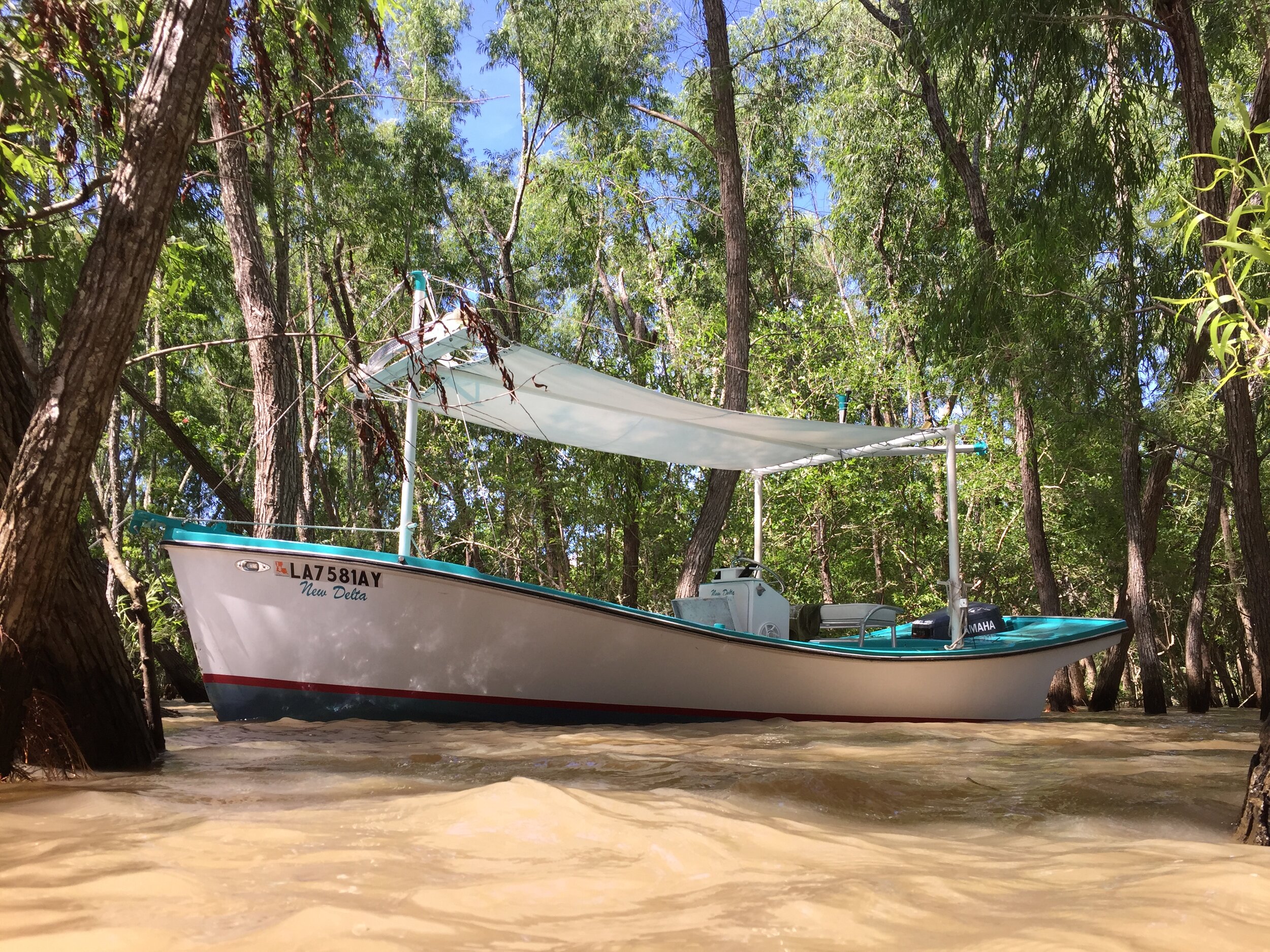
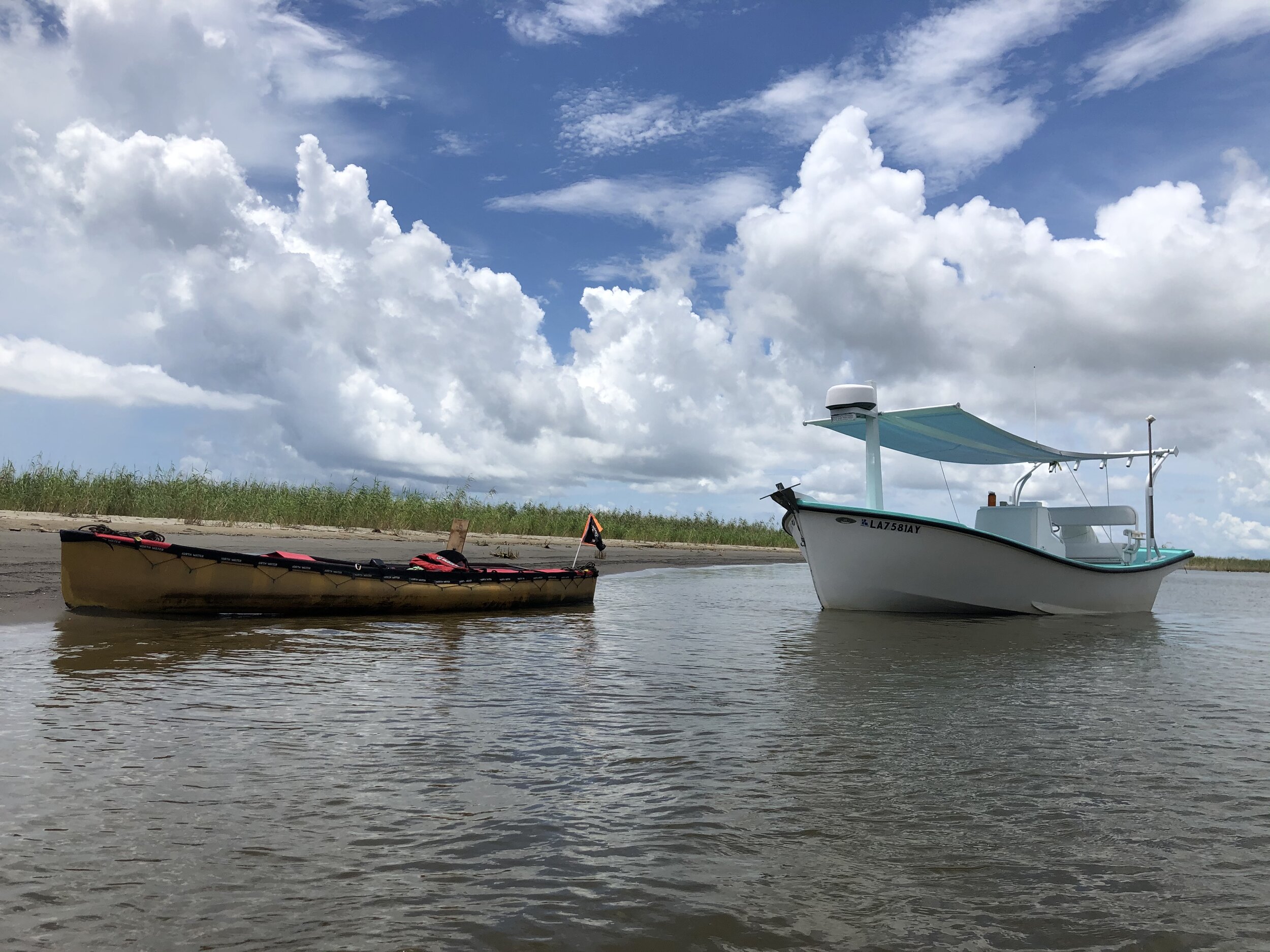
Our boat is the perfect platform for birding in the delta. It started as a commercial fishing boat in 1983. Built for the environments and conditions found in the delta, it went through a major refit in 2018. The large canvas and comfy seats make for a comfortable journey. The four-stroke outboard motor is quiet so we don’t spook the wildlife. Getting around from one major ecosystem to the next is quick. While the trip is long, we’re never too far away from the safety of a marina.

New Delta has a large canvas and comfy seats. It’s the perfect platform for birding in the delta.

New Delta has a large canvas and comfy seats. It’s the perfect platform for birding in the delta.

A typical birding trip departs from Empire, Louisiana, about an hour south of New Orleans.

Most trips depart at 9:00am but you can see more birds by scheduling a trip that has us on the water at sunrise or sunset. Birdcast has a lot of useful information to help plan the timing if your trip.

We begin with a brief history of the delta and an overview of our route and safety equipment. We ease out of the harbor and enter Bay Adams where you may see some magnificent frigate bird, which spend summers in the delta. The frigate birds enjoy the seemingly endless oyster poles that let them roost easily. As the seasons change the frigate birds, which locals call “storm birds,” give way to thousands of double-crested cormorants.

Nearing the barrier islands the abundance of brown and white pelicans increases. At the islands terns, gulls, and shorebirds like willet, sanderlings, and plover abound. Occasional we spot pairs of American oystercatcher.

Black Skimmers near Venice, Louisiana. Photo credit: John Nolter

Black Skimmers near Venice, Louisiana. Photo credit: John Nolter

Shallow lagoons hold larger wading birds like roseate spoonbills. Their bright pink hues and shy temperament make them a real treat to see feeding.

As we get closer to the river and the elevation increases we usually see Osprey. It’s common to see one with a fish, or small nutria in its talons. As the landscape and ecosystems blend and change the birds change along with them. The overlaps are sometimes curious. Some species, like great blue heron, are versatile and can be found all around the delta, other birds, like the black skimmer, are specialized and require certain conditions.

Great blue heron

Great blue heron

We stop about half way through the trip for a restroom break. You can bring a lunch to enjoy on the water or have lunch at the Venice Marina, a bustling recreational fishing marina. Around lunch, boats of all sizes come back to the dock to clean their catch.

After stopping for lunch we visit a cypress swamp. Prothonotary warblers can be found with their bright yellow plumage darting around the cypress trees.

Gulls on Pelican Island, a restored barrier island funded with Deepwater Horizon Fines.

Gulls on Pelican Island, a restored barrier island funded with Deepwater Horizon Fines.

As we head back upriver to our starting point through areas dominated by freshwater, waterfowl become the dominant species. Depending on the time of year you’ll see blue-winged teal, canvasback, and American coot.

In these areas that are building land more shorebirds can be found. White faced and glossy ibis are notable species in these new deltas.

Brown pelican

Brown pelican

On the last stretch back to homeport we sometimes see bald eagles near some of the higher ground with more mature trees.

The Birding Safari is a great way to see thousands of individual birds and dozens of species in just a day. Having a guide allows you relax and take in the scenery. We love it when we can help you check another species off your list.

Here is a sample trip itinerary:

9:00am Meet at the Delta Discovery Center in Empire, Louisiana (directions)

9:15am After a briefing we depart. Encounter magnificent frigate bird, cormorants, and gulls in this stretch.

10:00 Arrive at barrier island chain where we will see pelicans gulls, terns, sanderlings, plover, and oystercatcher.

11:00 Arrive at lagoons where we will likely see wading birds, waterfowl, roseate spoonbills.

12:30 Arrive at the Venice Marina for lunch.

1:30 Enter the cypress swamp. During spring and fall migration it is common to see painted buntings, prothonotary warblers, and other neotropical birds

2:00 Enter new delta areas where scarlet ibis, other wading birds, and rafts of waterfowl are common.

2:30 Visit the BS-11 coastal restoration project. Lots of waterfowl are here seasonally.

3:30 Arrive back at starting point.

This Rare Geologic Phenomenon Only Happens in the Mississippi River Delta

Mud lump vent series

Mud lump vent series

Flying in a Cessna airplane near Pass a Loutre was the first time I spotted one of these geologic absurdities. At first glance I thought the round and gray shape in the marsh was the lid of an old galvanized tank displaced from an oil and gas facility by a recent hurricane. 

Mud Vent

I swooped down to a lower altitude to get a better look where I noticed a chimney shape that must have been nearly five feet tall with mud and water bubbling out the top. The ooze was startling. I thought I may have stumbled onto a leaky pipeline or a long forgotten facility deep in the marsh. 

Mud Lump Vent from the air

Mud Lump Vent from the air

Another few passes and my memory was jogged. I had read about mud lumps and their associated phenomenon at the mouth bars off the Mississippi River Delta. These geologic absurdities have been rare in recent decades. Mud lumps are formations of clay that pop up from below, a process caused by the enormous weight of new delta deposits settling atop more plastic clays.

Paddy Bay in the 1840s was a pond, now with new land atop it the area features a series of mud vents.

Paddy Bay in the 1840s was a pond, now with new land atop it the area features a series of mud vents.

The buried strata of clay were pushed to the surface like a hernia, overnight in some cases. These new islands varied in size and speed, with some popping up overnight and others appearing over a number of months but nearly all breaking the surface during high water season when new deposits are made. One old story shared had goats living on a particularly large one in Dixon Bay. 

Mud Chimney

Belching cool liquid mud squeezed out from deep below the Mississippi River Delta, the mud volcanos and vents look more like a geologic process from Yellowstone or Iceland than a river delta. This video shows one in action. “There are similar structures and systems to the mud volcanos in other places on the planet.” says Dr. Alex Kolker, a scientist specializing in coastal issues, “That said, these mud volcanos are very rare in the US, and this is certainly one of the few places that an American could see them.”

Mud Lump Map

While the little mud volcano I stumbled upon isn’t a mud lump, the two are related. The Mississippi River Delta can sometimes seem geologically simple. Sand and clays flows downstream and stacks up when it slows down. These little mud volcanos were something different than normal, surface level deposits. However, the mud lumps are a unique occurrence here at the end of the Mississippi River. They’re so novel and unique, that they only occur at the end of certain passes (outlets) of the Mississippi River and found nowhere else on the planet. Pass a Loutre, Baptiste Collette, South Pass, and Southwest Pass all had mud lumps and the associated vents at one point in history. 

Mud Spring

The observation of mud lumps are becoming more rare as sediment loads in the Mississippi River Delta have decreased and river management pushes the sediment load off the continental shelf instead of into the marshes and mouth bars.

Mud Lump Vent near South Pass circa 2015

Mud Lump Vent near South Pass circa 2015

Still, they pop up from time to time. I was able to observe one from an airplane off Southeast Pass just a few moths ago but did not want to risk flying far from shore near dark. What I could see from the Cessna were waves breaking on black earth nearly half way between the South Pass 70 platforms and Southeast Pass. The location was so far from shore I though I may have sighted whales, there was no way it was a simple sandbar. When I tried to investigate by boat nothing was found on site. A few storms later and it was gone.

Mud Lump Redfish Bay.jpg

Quite a few studies of the mud lumps were accomplished in the 20th century when there was an economic need for understanding the phenomenon due to the blocked shipping channels. Those first hand accounts are incredible. One ship became stuck, even after the pilot just traveled downstream in the same spot. After waiting overnight for tugs to arrive the next morning the bow was well out of the water.

Exploratory borings on a mud lump

Exploratory borings on a mud lump

You can visit the Mouth of the Mississippi River on one of our trips to see the places these mud lumps used to pop up. If you’re luck you may see one too.

-Richie

Mudlump vent as depicted by spanish explorers.


I Took a Shrimp Boat and Made the Ultimate Ecotour Vehicle

It was a labor of love to turn this old shrimp boat into the ultimate eco tour vehicle.

It was a labor of love to turn this old shrimp boat into the ultimate eco tour vehicle.

Louisiana has a long tradition of building tough boats tailor made for the local conditions. So when Delta Discovery Tours was getting started I knew a traditional Louisiana boat was the only thing that could do the job well while giving folks an authentic experience. The areas where I operate have individual nuances that require it. Some places are ten inches deep, other spots have six foot high wakes from container ships. A vessel that is capable in a multitude of environments and safely gets six passengers around the coast -from cypress swamps to barrier islands was a must. This is the story of how I found and modified the perfect boat for the job.

Lafitte Skiff Project

Back in 2010 when I started picking up trips via word of mouth I was using a mud boat nicknamed Trenasse, the Cajun French word for a small cut in the marsh. It’s a great boat for exploring the swamps, but I needed to extend my operating area and get folks around quicker. After considering a dozen types, and looking at hundreds of individual boats, the search was narrowed to an old school Lafitte Skiff.

THE PERFECT BOAT

The Lafitte skiff I found had a lot of potential. It was built by Jefferson Fiberglass in Harvey, Louisiana in 1983. The boat was rigged for shrimping in Mississippi and came complete with 36 foot trawl with turtle excluders, double cathead winch, picking boxes, and stout rigging. After some negotiation and a handshake warranty with the policeman owner, I headed back to the coast. One of the things on my list was a full length canvas. This boat had great rigging and a canvas to stay cool on hot days.

The first splash with a boat is always a tense moment. The old two-stroke engine had a lot of power and had the boat planing in no time. The boat would run nearly forty miles an hour.

Rigged for Trawling

Rigged for Trawling

I made the boat ready for ecotours in the delta by removing nearly 300 pounds of shrimping gear and adding comfy seats. The boat went right into service and increased the operating area for Delta Discovery Tours significantly. Now barrier islands and the river’s end were in reach.

The old engine, while it was smokey and loud, was a reliable as the day is long, and simple to service. Even on cold days it would fire right up, a testament to running it three times weekly and Yamaha’s solid workmanship & design.

Over the miles and trips folks would ask why the boat wasn’t named. One day, while giving a presentation before a trip I was sharing the positive news about new lands emerging from bays nearby. When I uttered the words “new delta” I stopped in my tracks. Boat names have captivated me since I was a boy. The perfect name is elusive to so many boat owners. In an area with so much land loss, the hope and freshness coupled with the operating area in the Mississippi River Delta made New Delta the perfect name for this boat. I ordered lettering soon after.

New Delta in the Bohemia Spillway.

New Delta in the Bohemia Spillway.

DECISION TIME

A pinhole in the 35 year old fuel tank was starting to make bilge smelly. The console, a plywood and fiberglass concoction was showing age. I had a potential buyer for the old engine so it was time to make a decision.

New Delta as we ran her before the refit. Based on time proven designs, she is the perfect boat for exploring the delta.

New Delta as we ran her before the refit. Based on time proven designs, she is the perfect boat for exploring the delta.

At some point in the past the boat had a deck overlay with new fiberglass. The wood underneath was getting rotten. When adding seats the drill bit came out of the deck looking like it had mud on it. Cutting a hole in a perfectly good boat is never an easy decision and always leads to project creep. Folks ant to get on a safe and comfortable boat. I held started pulling the boat down to the bare hull.

At the end of the day I’m glad I made the decision. I found some issues with the keelsons, the longitudinal runners that give the hull support. Thirty-five years of service took their toll on the wood. I stripped the boat completely to get it ready for the next thirty-five years of service. Lingering issues with the console and fuel tank could all be repaired during the refit.

Thankfully, I had a spare boat to keep rolling with tours. That was key to keeping the service going.

New Delta at Hydroflat prior to new gel coat.

New Delta at Hydroflat prior to new gel coat.

Project creep is a real thing and hard to avoid on a project like this. With the new composite keelsons and deck going in, the boat was going to need a new gelcoat job to seal in the fiberglass work. I wasn’t looking to build a paint booth and the gnats and mosquitos would have cut into the quality of the paint job, so I selected Hydroflat in Des Allemands. They did a great job and had the job done in a week.

Installing the console

Like any other project this one was several smaller projects wrapped into one. Scheduling concurrent work was tough. The above photo shows the lengths I’d need to go to make sure things were being built to the correct size.

CONSOLE

I was able to save some time by having the console built with the fuel tank in one piece. The aluminum fuel tank had been under the deck for three and a half decades so it didn’t make sense to put it back. Instead it was blended into the new console, a common feature on the more modern work boats in the delta. The new tank can hold nearly sixty gallons. Now with a more fuel efficient four stroke engine the range and operating area has increased by a good bit opening up new islands and multi day trips into the delta.

Wiring Console

I was trying to keep costs down so I prepped and painted the console at home. This was the first time I ever painted with compressed air. It took more than a few coats with sanding in between. I was surprised at how nice the paint came out. South Louisiana’s humidity made getting started a longer process for a first timer. Once the moisture issues were resolved the paint went on well. I used two part polyurethane primer and paint.

The console wiring was a relaxing process. It made sense to leave extra circuits for add-ons that would undoubtedly come later. Foreseeing a lot of time spent on the wiring job, the first order of business was adding a LED floodlight in the console. That helped a bunch for the really intricate work. The VHF radio was hidden away from the sun and spray inside the console doors. I tried to plan ahead and avoid drilling any unnecessary holes in the console to avoid corrosion. The fuse panels are mounted on marine lumber attached to 90-degree one inch aluminum angle iron welded to the inside. Ultimately, the batteries ended up in the bow to help balance the boat. All of the wiring is with dielectric grease and heat shrink.

Console wiring in progress.

Console wiring in progress.

Mirroring larger ship construction in modules, when the new console was installed in the boat all I had to do was run wire and fuel line. The batteries, panel, and helm were already in place. This saved countless trips climbing over the side of the boat to the workshop. When the console was mostly complete and the boat came back from getting gelcoat I married the two.

Engine and console married

Engine and console married

Before the refit guests would remark at the simplicity of New Delta. I wanted to keep that clean and simple look while upgrading the boat to fit 21st century needs. The controls were spartan and there was no GPS. Only a small switch panel and tachometer were near the wheel. The new console keeps with that old vibe while giving me the 21st century tools of radar, gps, and a depth finder to do these trips as safely as possible.

Console with GPS

ENGINE

After considering a number of factors including reliability, efficiency, and what trusted folks nearby were saying I decided to repower with a Suzuki 140. The class of engines Suzuki builds between 90-140HP weigh just about the same and the cost to get more power was negligible. The engine burns around 3.5-4.5 gallons per hour at cruise and no more the 10GPH at wide open throttle. The old two stroke was more than double that.

After seeing Suzuki outboards prevalent on smaller oyster boats I asked an oyster fisherman why he chose to use the motor. He told me “that engine will pump peanut butter through the water pump.” Those fishermen circle constantly in muddy water dredging oysters.

Here in the delta, it’s not if you’ll run aground, but when. Shallow water is the norm and sometimes the river shifts sandbars and fills in old canals and bayous. Having an engine that can handle the tough conditions was a must. Still, after a year in service the water pump has been intact so no complaints.

The Suzuki was less expensive than the Yamaha of comparable size too. Suzuki’s engineers chose to use a large gear reduction on their engines. This allows for a bigger diameter propeller. The ecotour mission needs power and not speed, this gear ratio and bigger propeller get the boat on plane easily and make a good fit.

Duvic’s Outboards in Harvey installed the engine. They did a top notch job and had me out the door quickly.

After Outboard installation at Duvic’s

After Outboard installation at Duvic’s

COMING TOGETHER

Hindsight is always 20/20. I wish I had the rigging rebuilt before the gelcoat was complete. I was intending to use the old rigging but ended up upgrading. B&T Welding did the construction. I designed lines with nod to the past while taking care of more modern needs like a sturdy platform for the radome and canvas. Many old lugger boats had a square tapered mast like the one pictured below. The robust mast let me skip the cable rigging to open up more space for photographers.

Lugger Boat Rigging

Some uncertainties about what radar I was going to choose led me to skip adding the bracket during construction. I didn’t know if I was going to buy a radar this year, or five years down the line so I skipped it only to add one a few months later.

New Zealand built winch is really helpful for soft groundings.

New Zealand built winch is really helpful for soft groundings.

One of the nice-to-haves was a winch, its great for soft groundings on a cold day. I wanted the winch to have a sturdy foundation so I had a half inch plate added to the mast base.

The refit was absolutely a labor of love. New Delta is more capable than ever. I’d feel comfortable taking the boat anywhere along the bottom third of Louisiana. Lots of folks stop me at boat launches to talk about the boat. Everyone in coastal Louisiana seems to have a story they want to share about a Lafitte Skiff. So many folks had one as a family boat here in South Louisiana with weekends spent at the camp, trawling, or headed to the beach.

I tried my best to create a much safer and environmentally friendly boat for giving ecotours and swamp tours near New Orleans into the Mississippi River Delta. With increased range I’m better able to serve our specialty guests on longer trips. The ability to see through fog and darkness gives me more confidence while navigating the river.

Private Swamp Tour Boat

In the future I would like to add a bracket for the ice chest with a seat, otherwise New Delta is finished up.

I was able to build a completely custom ecotour vehicle, perfectly crafted to give you comfort while stretching the realm of possibilities for tours in the Mississippi River Delta.

The internet has brought creatives together in a hive-mind where ideas are flowing freely. You don’t have to think of every little clever upgrade yourself, but you can build on those forged by others to get a springboard, making technological leaps quicker and across larger geographies than by just word of mouth. In a way, we have more communication tools than the old school Louisiana boat builders. We can share ideas across the planet in moments. I hope this build will inspire other folks to take something old and make it cutting-edge again. This is why I want to share the story of how I turned this little shrimp boat into the ultimate eco tour vehicle.

-Richie

Lafitte Skiff for Hire

Bury Me on the High Land

Point Pleasant Cemetery, across the Mississippi River from Empire, Louisiana. Courtesy Findagrave.com

Point Pleasant Cemetery, across the Mississippi River from Empire, Louisiana. Courtesy Findagrave.com

One of my first jobs was running cattle under the guidance of Captain Phillip Simmons. The east side of the Mississippi River, across from Empire, Louisiana, where I grew up, is unoccupied by people. Its tough country, a land ruled by nature. The ground is incredibly low and soft. Four-wheelers and horses can only cover the higher territory or else they sink and become a burden on the operation. Men on foot were needed to drive the cattle from the marsh to the ridges and levees for inoculation and shipping to market. The cattle would make these shifts in clear patterns. Each herd had its own personality. After awhile the job became predictable and gave me the time to get to known the other rustlers, mostly shrimpers during the slow season.

Around 1200 head of cattle live on the East side of the Mississippi River from Bohemia to Venice.

Around 1200 head of cattle live on the East side of the Mississippi River from Bohemia to Venice.

I was on one of these cattle herding trips the first time I went to the Point Pleasant Cemetery. It was nearly dark and I was with Capt. Phil in a flatboat headed to pick up the cattle crew at the end of the day. We eased into a tight ditch with tea colored water. The small cut was too narrow for the boat to turn around. At the end of the dead end canal, just past some decrepit oak trees was the graveyard. Live oak, spanish moss, and palmetto occupied a small mound, what I found to be the older section of the graveyard, beyond that were the newer graves. As we pulled in a couple crows took off. The hair on the back of my neck stood up.

Everyday tides put water into the Point Pleasant Cemetery

Everyday tides put water into the Point Pleasant Cemetery

Beyond the canal bank, hand dug by homesteaders sometime in the mid 1800s, were tombs in various states of decay. Most from the 1830s through the 1910s. Oddly enough one looked nearly brand new. The tomb’s owner having occupied it in the mid 1970s. The facade well-kept by my captain that evening, a caring nephew. At the time I had no idea the little cemetery even existed. The place gave me the creeps.

Captain Phillip Simmons during the Deepwater Horizon Oil Spill in 2010. the Ostrica Locks were fully opened to flush oil from the marshes.

Captain Phillip Simmons during the Deepwater Horizon Oil Spill in 2010. the Ostrica Locks were fully opened to flush oil from the marshes.

Captain Phil shared a story with me about a man that refused to be buried in the cemetery. During a yellow fever epidemic, the man’s wife and young daughter died in short succession. He built an elaborate and sturdy tomb and mourned daily after working the oyster reefs. During a particularly bad hurricane in 1919, the well built, and water tight tomb floated off and wasn’t found. After a futile search the man said, “To hell with this place, bury me on the high land.”

Around that time, a new canal had just been dug connecting Bay Adams and Grand Bayou on the west side of the Mississippi River with steam shovels. The spoil banks were nearly thirty feet high. A few years later that’s where the man was buried.

Only a channel marker and oyster poles delineating leased water bottoms suggest where that canal bank existed. Extreme land loss, caused by canal digging and levees, claimed that marsh years ago.

The Woodmen of the World Fraternity would cover burial cost for members and their family. Not many harvestable trees are in the area any longer. This petrified wood stump likely traveled by steamboat to Point Pleasant.

The Woodmen of the World Fraternity would cover burial cost for members and their family. Not many harvestable trees are in the area any longer. This petrified wood stump likely traveled by steamboat to Point Pleasant.

While in better shape than the lost land across the river, today the cemetery can hardly handle high tide without a few inches of water covering the ground. Low spots are permanently submerged. Cattle haphazardly graze through the tombs, clumsily knocking the markers around in the soft deltaic soils. Its a place largely forgotten save for a few hunters and Capt. Phil’s family and friends.

Point Pleasant Cemetery in 2019.

Point Pleasant Cemetery in 2019.

Over the years, Capt. Phil shared much oral history of the area with me. As we would pass various landmarks, some as simple as a lone live oak tree or old cattle bridge, he shared the last names of the homesteaders, their specialty, or how they were related to him. Names like Johnson and Cosse were common. With a little imagination, you could almost picture the neatly kept homes with West Indies style roofs, and long piers into the river awaiting weekly packet boats with names like El Rito and New Majestic.

Russell Lee 1938

Russell Lee 1938

Those boats would bring mail, household goods, and elixirs ordered from Sears catalogs. On the return trip to New Orleans cattle, oysters, and citrus fruit were headed upstream. There were rows of orange trees, thoughtfully mended cattle pens, and piles of bleached oyster shells scattered across the landscape. Often his stories would highlight practical ways people adapted to life in the delta and how self determination, ingenuity, and a positive attitude allowed the people to lead an easier life.

A young man inspects the citrus crop. Plaquemines Parish is know for the once bountiful citrus harvests. Arthur Rothstein 1935, Courtesy Library of Congress

A young man inspects the citrus crop. Plaquemines Parish is know for the once bountiful citrus harvests. Arthur Rothstein 1935, Courtesy Library of Congress

It was a simple and tough life, but an honest one. It was turned upside down after the great flood of 1927, which kicked off major flood control improvements all along the Mississippi River Valley. The communities and homesteads from Bohemia to Ostrica were forced from their homes and land. This created much tension that split families apart. The creation of the Bohemia Spillway, a pressure relief valve lauded to save the city of New Orleans from flooding was needed for the greater good. Some folks literally took their homes apart board by board and reconstructed them across the river in Empire, Louisiana. This land was viewed as subpar in both elevation and quality for farming. Other folks left the state entirely, disenfranchised, looking to start fresh elsewhere. It took more than 60 years before the courts decided the dependents should be compensated for the loss. Today you can find land owners as far as Detroit and Atlanta paying $6 annual property tax for a splintered percentage interest in a plot within the spillway.

Arthur Rothstein 1935, courtesy Library of Congress

Arthur Rothstein 1935, courtesy Library of Congress

Looking at the landscape can be equal parts looking into the future as the past. The Bohemia Spillway shows how areas of Louisiana will look after the people leave. Not much is left of those old home sites. Only some bricks, rusted farm implements, and bottle shards remain.

Left behind ground aerator.

Left behind ground aerator.

A six foot potato ridge levee separates the river from the back marshes which are not nearly as firm and dry as 20 years ago. The old remnant levee is doing more harm than good at this point, choking off what could be an annual replenishment of sediment across the landscape.

From Pencil Points, April 1938

From Pencil Points, April 1938

Those levees the early settlers helped to maintained still hold back river water below Bayou Lamoque, just downstream from the official ending of the Bohemia Spillway. The area north of the Bayou Lamoque, and south of Pointe a la Hache, had the levee degraded by bulldozers for the actual spillway. That ground is several feet higher today due to that annual overtopping of the natural levees in spring floods.

The older Bayou Lamoque Diversion built in the 1950s, The newer structure is similar with construction completed in the 1970s. Note the cattle in the bottom right of the photo.

The older Bayou Lamoque Diversion built in the 1950s, The newer structure is similar with construction completed in the 1970s. Note the cattle in the bottom right of the photo.

The new sediment deposited in the Bohemia Spillway outpaces the natural sinking of the delta making this the only geography in Plaquemines Parish where the land is getting higher over the years. Black willow grow along the river and renewed distributaries. Large live oaks extend nearly all the way to the back levee ditch. Six feet of elevation is common nearer to the river, and those areas are dry most of the year. The understory is clean and largely free of invasive species. Deer abound in the active spillway. In contrast, the area below the spillway, delineated by Bayou Lamoque downstream, is dominated by Chinese tallow trees and soft, low marshes.

The batture of the Bohemia Spillway is overtopped annually during spring floods.

The batture of the Bohemia Spillway is overtopped annually during spring floods.

The land went back to nature in the most complete way. The Bohemia Spillway is about as close as you can see to what things were like before the Europeans arrived in the Mississippi River Delta. Now with Mardi Gras Pass digging in, back bays are being converted to flats and then marshes. The cycle of building land continues.

Uhlan Bay, near Mardi Gras Pass, with new flats breaking the surface.

Uhlan Bay, near Mardi Gras Pass, with new flats breaking the surface.

On our trips you can see these special places for yourself and hear the stories of how they were occupied, abandoned, and what could be. Come see what the future holds just downstream.

-Richie

Return Logistics for Mississippi River Paddlers

Finishing a human powered Source to Sea journey, a 2300 mile trek beginning at Lake Itasca, Minnesota and ending here, at the Mouth of the Mississippi River in Venice, Louisiana is a feat of human achievement. You’ve dodged weather and barges. You’ve made it through long stints in the wilderness with just your craft and wits. There is just one last detail, how to get back upstream the roughly twenty-five water miles past the nearest road?

One journey is over, the other is just to begin.

One journey is over, the other is just to begin.

The reasons people set off to paddle the entire Mississippi River are as numerous as the craft. Some folks are raising awareness for a favorite cause like juvenile diabetes, some are out to break a record, still others are simply seeking adventure. The end of the journey is always a special moment to be a part of.  We try to share that with as many folks as possible.

A cool April day. Much colder than I’m used to in Louisiana! @ Lake Itasca, MN.

A cool April day. Much colder than I’m used to in Louisiana! @ Lake Itasca, MN.

I’m familiar with the needs of Mississippi River Paddlers. I’ve helped nearly three dozen paddlers of all types of vessels; from stand up paddle boards, to kayaks, to canoes, there was even a catamaran made from recycled water bottles! My home is just steps from the Mississippi, deep down in the Birdfoot Delta, so it’s natural that I’ve met so many inspiring folks coming downstream on their adventure. Meeting paddlers was organic and by chance, I’d run into paddlers and give them a lift back up to Venice or New Orleans.

Alex Linnell nearing the Pass a Loutre Lighthouse to become the first person to stand up paddle board the entire Mississippi River.

Alex Linnell nearing the Pass a Loutre Lighthouse to become the first person to stand up paddle board the entire Mississippi River.

When Dale Sanders finished his source to sea journey to become the oldest person to paddle the Mississippi River we worked with partners to be able to share the moment. Captain Bubby Reno was able use his shrimp boat as a staging vessel to bring back the paddlers and gear. We brought back friends and family in the faster boats. Around twenty folks were able to be there to witness the record breaking at the river’s mouth just downstream from Port Eads, at the end of South Pass with the Gulf of Mexico in the background. A champagne toast and speech were in order. I’ll never forget that day.

IMG_5563.jpg

After paddling for sixty to eighty days a ride back upstream is a welcome luxury. The Mississippi River below Venice, Louisiana has many high speed offshore boats which are fast and throw larger wakes than towboats. I used to captain some of these boats, The crews on the water here are some of the most courteous on the water but sometimes they can’t see the relatively small craft being paddled in the three quarter mile wide river. This is where we come in. After the arduous journey we get you back upstream quickly and safely. For many, this is the fastest they’ve traveled the whole time they’ve been on the river. 

We offer a few distinct options for paddlers:

  1. We just pick you up. Not much fanfare, but a quick return to Venice and civilization.

  2. We bring three family members to watch you finish.

  3. We arrange a larger flotilla to allow for the right amount of family and friends to watch as you finish. Send us a message to get this started.

  4. While it only happens once or twice a year, we bring folks to the airport after their trek.

Even if you don’t need our services and just want an update of conditions on the river and in the passes give us a call. We’re all around the delta and have a good idea of what current conditions are like. We monitor where the dredges are working, the condition of the campground at South Pass, water levels, and a multitude of other factors needed for a safe journey to the river’s end. River Gator has a great overview of what to expect in the Bird’s Foot Delta, although conditions change regularly.

Chris Ring moments away from reaching mile marker zero. Chris swam the length of the Mississippi River to honor Gold Star families. We were able to help get friends and family on site for the grand finish. Check out New Delta in the background as th…

Chris Ring moments away from reaching mile marker zero. Chris swam the length of the Mississippi River to honor Gold Star families. We were able to help get friends and family on site for the grand finish. Check out New Delta in the background as they reach Mile Marker Zero.

How it works:

  • We get in communication. We need to have a general idea of when you’ll be making it to the Venice area, how much gear you have aboard by weight, if you’d like to have guests join us or not. I’ll update you on weather and other river conditions.

  • From there we get underway and rendezvous somewhere along your preferred route or pick you up the following morning.

  • At the end, we help load your gear. Then head back upstream to the marina of your choice. We can bring you straight to the marina, offsite lodging, or the airport. The return trip is straightforward. Starting in Venice with a pickup and return can be completed in a day.

I can only describe the emotion from my perspective when folks finish the river. There are feelings of pride, accomplishment, and then a feeling of what’s next?

Send me a message or call if you’re interested in arranging for a ride back from the end of your river adventure! 225-287-2843

Good luck on your trip!

-Richie

Bayou Country Loop, A Recon Trip

COVID-19 has been hell on New Orleans and the tourism industry. New Orleans saw early cases and a peak much earlier than other parts of the country. Out of an abundance of caution, each trip on the books was either canceled or rescheduled. Thankfully folks close to Delta Discovery; our partners, friends, and family are all healthy. Richie took advantage of the lack of trips and quarantine to finish up some projects and begin a few upgrades. One of the highlights was a development and reconnaissance trip to give folks the option for a multiday expedition through Bayou Country. Richie brought New Delta on a 325-mile trip around South Louisiana in search of the perfect route for folks to soak in Cajun Country from the water.

A home along Bayou Pointe-aux-Chenes, Louisiana.

A home along Bayou Pointe-aux-Chenes, Louisiana.

First Day

Starting in Empire, Louisiana at the Delta Marina I made my way over to Grand Isle via No Man’s Land, Lake Washington, and the Gulf of Mexico. The winds were light, maybe five or so out of the southeast. I passed on the bayside of Grand Isle passing a floating oyster farm before heading up to Leeville. 

Men fishing at the The Old Leeville Cemetary, they had no idea.

Men fishing at the The Old Leeville Cemetary, they had no idea.

There’s an old cemetery falling into the water on the point across from the new Leeville Bridge. Two guys were over there fishing so I stopped a bit down the bank. They didn’t have a clue what they were standing on but had a full stringer of trouts and reds. I passed under the bridge heading over to Pointe-aux-Chenes. 

That passage was through some still intact salt marsh carved up by oil and gas canals. There is still a good bit of nicely kept camps on the other side of Leeville. I took Bayou Pointe-aux-Chenes until it petered it. At the spot where the bayou was filled in there was a big steel pipe cross. The top looks like it had more than one lightning strike over the years. I backtracked a bit and made my way over to Point-aux-Chenes.

A steel cross marks an old cemetary south of Pointe-aux-Chene

A steel cross marks an old cemetary south of Pointe-aux-Chene

Point aux Chenes was busy. Lots of folks were fishing and crabbing. When I pulled up, I was like... why are these slips so small? The busy marina I pulled into was a kayak marina. The place was packed with people coming and going. Lisa Mullen, one of the owners of PAC Kayak Rentals, was telling me about how her and her husband moved from Baton Rouge and restarted down here. There was so much energy there. If you’re ever in the area they have a stilt house and houseboat for reasonable rates. I hope they continue to do well. 

An older wooden double rigger shrimp boat at Pointe-aux-Chene

An older wooden double rigger shrimp boat at Pointe-aux-Chene

After kicking off from PAC I went up Bayou Point aux Chenes to take in the scenery. Lots of folks still live on the bayou there and the boats range from window deep in the bayou to immaculate. After back tracking I went down the bayou to see the wild horses. They look great -healthy and curious. 

Wild horses just down the bayou from Pointe-aux-Chenes

Wild horses just down the bayou from Pointe-aux-Chenes

After leaving the area I went west to Isle de Jean Charles. I was good on fuel but never wanting to pass up a pump in uncharted territory (I knew there would be about 70-80 miles without fuel later) The guys at the Island Marina were helpful in checking over my route. They gave me some nearby landmarks that really helped, like The Lone Tree. They didn’t have fuel, but I bought some beer and snacks to say thanks. Barq’s root beer and YooHoo remind me of being on the shrimp boat as a kid so I grabbed some. I thanked the guys and kicked off. The whole place had an old school bayou vibe to it. I wish I could bottle that up.

Bayou ingenuity

Bayou ingenuity

From the Island I headed down Madison Canal and past some camps south of Montegut. This was one of the first floodgates I passed through outside of Empire on this trip. Anyway, I took the Bush Canal over to the bayou that cuts through Chauvin. I stopped for fuel, I really wanted to explore the area more, but I was trying to make it to my campsite by dark. The boats in Chauvin were old school and cutting edge. The people at the fuel dock (half fuel dock, half convenience store) were curious about my boat. When I mentioned the dock attendant looked a lot like someone I know with family in the area the guy sitting at the counter gave me a solid history on the family and filled in details that even I didn’t know from before they made their way over to Plaquemines. I rinsed the boat in the freshwater before leaving completely filled to the brim with fuel. It was the most I ever had in the boat. Probably sixty gallons.

On the way out of Dularge I snuck under a drawbridge, not under the main span but off to the side. My boat has a mast with probably seven or eight feet of air draft, and it was just a few inches of clearance under most of the bridges. The marina store had hot shrimp and crawfish boudin, so I enjoyed that before making the passage over to the next bayou settlement. Lots of folks were fishing on the bank in this stretch.

The local government and citizens are serious about flood control and have taken things into their own hands by taxing themselves, twice, to pay for upgrades and building levees and floodgates at an impressive clip. Evidence of innovative structures and constant improvement was all around. I kept thinking it was progressive, but it should be, this is basic needs for dealing with the immediate impacts of storm surge, sinking lands, and sea level rise.

Floating Barge Gate

Floating Barge Gate

The five bayou fingers that hang down toward the gulf from Houma are Louisiana’s true bayou country. The people there possess a pragmatic approach to life born of isolation and proximity to the water. Their generosity and willingness to share their knowledge with me were a welcome treat. New Delta was a constant conversation piece. The classic Louisiana skiff brought on many conversations that I’d love to revisit soon.


A church along Bayou Dularge

A church along Bayou Dularge

Lake Boudreaux separates Chauvin from Dulac. I snuck under another drawbridge where there was a big shrimp dock. Around the bend was a Coast Gaurd station. This area had a lot of commercial fishing boats. I got into the Houma Navigation Channel and made my way down Falgout Canal after waiting on a pontoon bridge. There was some heavy iron in the Houma Nav which included a gigantic former McDermott crane barge and some platforms in the process of being chopped up. 

Another classic gone

Another classic gone

Dularge had a narrow bayou that seemed pretty sleepy. The bayou had a good bit of cattail along its banks when not lined with fishing camps and smaller commercial fishing boats. There were a few homes and churches as civilization slowly tapered off to oyster docks and a few camps at the end of the road. Eventually only power poles lined the bayou. I passed a few oyster boats returning for the evening. The changes in the vegetation gave me clues about the salinity. This stretch reminded me of home in the birdsfoot.

Bayou Dularge

Bayou Dularge

Accessible only by boat, numerous camps were to the south. I made camp for the evening about an hour before sunset. By this time a nice sized storm to the Northwest was dispersing. 

A typical fishing camp beyond roads and utilities.

A typical fishing camp beyond roads and utilities.


Second Day

Began with a beautiful sunrise and tranquil skies. A nameless oyster boat meandered down through the bayou to the fishing grounds with a couple on the bow. I headed to the gulf where I stopped and ate breakfast away from the greenhead horseflies. There were plenty shrimp boats and dolphins. The boats were stern cabin lugger shrimp boats common to the Houma area. Most were pushing skimmers.

I rode the beach until I made it to a pass that leads into Four League Bay. The sun was starting to get the wind going by this point so I rode the east and north shore of the bay. It was a little longer but more comfortable. The bay was loaded with crab traps. I had to dodge them. The alligators must get an easy meal from the crabbers, three or four big ones approached the boat. All eight foot or bigger.

Bayou Sunrise, the whole trip was worth this 15 minute stretch

Bayou Sunrise, the whole trip was worth this 15 minute stretch

Four League Bay connects to the Atchafalaya Delta. I watched the depth finder closely as I made my way around in there. It was the one place I was a little worried about during the planning. No problems making it in, though I only had two feet under the boat for a while. Once I got into the delta and freshwater again, I found a sand bar and stopped for a bath. Note: I’ve spoken with several Airbnb owners with adjacent water frontage who are interested in partnering for this route.

The Southwest Reef Lighthouse, now relocated to Berwick, the opposite bank at Morgan City

The Southwest Reef Lighthouse, now relocated to Berwick, the opposite bank at Morgan City

There is so much idle iron in Morgan City, Amelia, Houma, and Larose. Entire fleets of new offshore supply boats are starting to fade and rust. Hundreds of boats are cold stacked waiting for better oil prices and increased demand. It was incredible to see. Most any other time they’d all be offshore. I hope they can be repurposed for other uses.

Idle Offshore Service Vessels due to the low price of oil

Idle Offshore Service Vessels due to the low price of oil

There’s a stretch of ICWW between Amelia and Houma that is cut through some amazing cypress swamps. Houma has a Venice, Italy-meets-industrial-Louisiana vibe to it. Canals go all through the town. There are so many boats of all types to be seen, everything from bass boats to hundred-foot-tall offshore supply boats. 

Nearing the Main Street Bridge in Houma

Nearing the Main Street Bridge in Houma

In Houma I stopped at the municipal marina under the bridge and walked a few blocks for a bowl of gumbo. The marina is well kept with fine docks, landscaping, and shore power set up for transients making their way in the ICWW.  A walked to a restaurant three blocks away for a bowl of gumbo. It was nice to stretch my legs and enjoy a hot meal. Coming back to the boat was something special. Located between two bridges, in a park-like setting, the boat looked better than ever.

New Delta at the Houma Municipal Dock

New Delta at the Houma Municipal Dock

About a mile after I got going again, I came across some folks that needed a tow. Their motor blew. I lost about 45 minutes, but the conversation was good and it’s always nice to help folks. Its also an unspoken rule of the bayou. First one to come across someone in distress helps immediately. Karma.

Our Lady of the Rosary Catholic Church in Larose, Louisiana

Our Lady of the Rosary Catholic Church in Larose, Louisiana


Back on the ICWW the Larose floodgate was closed, I really wanted to go down Bayou Lafourche to Leeville but I didn’t have the daylight to waste waiting on the gate. By the time I would have been able to transit the gate it would have been six o’clock. So, I continued down the ICWW tow boaters refer to as “The Ditch” Before getting to Lafitte I passed through Bayou Perot then down the Barataria Waterway.

Lafitte was once home to the infamous pirate Jean Lafitte. The banks of the Barataria Waterway are lined with elevated homes suburban slab houses with shrimp boats in backyards. A mound by First Nations folks has a modern cemetery built atop it. There is a great restaurant near the water in Lafitte called Voleo’s.

The Church at Grand Bayou Village.

The Church at Grand Bayou Village.

I took some small bays and bayous before going under the bridge at Lake Hermitage and then through Grand Bayou Village. Grand bayou Village is home to about 45 folks who live along the bayou. Residents take a boat to their homes. Up until Hurricane Katrina in 2005 there was still a yellow and black school boat. From Grand Bayou Village to homeport in Empire, Louisiana was about a half hour or so.

Abandoned home at Grand Bayou Village, Louisiana

Abandoned home at Grand Bayou Village, Louisiana

That last stretch felt like coming home in so many ways. Throwing the line around the piling at the Delta Marina I couldn’t help but to marvel at how everything went as planned. There were no mechanical issues or groundings. The concept, the navigation portion, was proven. After a few days of reflection I decided this trip should be spread out into a three or four day trip with speakers and elders sharing time and a meals with guests at select stops. It was a navigational test to prove the concept -the culture is the real attraction and I hope to share it with you soon on this trip.

-Richie

Regina Agu: Passage

Passage. One word so succinctly sums up so much. It could mean the small cuts, trenasses, and bayous that New Delta traveled through with contemporary artist Regina Agu as she revisited many of the sites painted in the 19th-century by artists who were trying to convey the uniqueness of Louisiana’s watery frontier. Or, it could be the changes, the passages, that the landscape and people went through as humanity colonized the delta since that time.

IMG_4853.JPG

Regina’s 100-foot-long installations that hang in the entry to the New Orleans Museum of Art set the tone for “Inventing Acadia: Painting and Place in Louisiana.” Her work titled, “Passage,” felt almost airy compared to the dense scenes showing the landscape before humanity clear cut, moved out indigenous folks, and built levees. The size of her work is massive, consuming most of the wall space in the museum’s Great Hall. Yet when people walk past, the canvas moves like the water and roseau in the art. The piece defies the solid landscapes of a Louisiana past like the below.

Life Along a Louisiana Bayou 1877 Everett B. D. Fabrino

Life Along a Louisiana Bayou 1877 Everett B. D. Fabrino

Satellites, Algorithms, and Wetland Changes in the Delta

One of our recent trips had us working with a NASA scientist out of the Ames Research Center in California. Dr. Chris Potter is working with scientists at Tulane University to map out recent gains in marsh vegetation cover along the rim of Breton Sound.

Path for data collection.

Path for data collection.

One of the areas where we focused was across the Mississippi River from Fort Jackson near Fort St. Phillip where Chris is ground truthing data collected by NASA satellites to determine just what is new land. The team then uses vegetation reflection and elevation data to identified the many new areas in the estuary where land has been restored following the storm surge inundation from Hurricanes Katrina and Gustav in 2005 and 2008. Our trip was just as the water receded after the record flood year of 2019. It was exciting to see some of the newest land up close. A few places far from land will soon be emerged part of the year. The river is doing what rivers do, building land!

Wetlands on freshly built land.

Wetlands on freshly built land.

On the trip he was able to verify hundreds of locations where new land has been built and to validate the latest results from satellite image classifications of new marshland vegetation cover versus floating aquatic plants on the open water near Fort Jackson. Delta Discovery was able to get Chris into the heart of a coastal restoration project, BS-11 where a good bit of land has been built in recent years. Here is a time-lapse of that area from 2006 through this summer. On this trip we used the mud boat, which is a great tool when working with scientists. It allows access into areas that are in transition and is super efficient.


-Richie

The mud boat gets us where the critical data is found.

The mud boat gets us where the critical data is found.